Photographs of the Libby South Fire Kill Salvage Timber Sale
(Click here to get back to the
Libby South information page)
Photographs of the Libby South Fire Kill Salvage Timber Sale taken on February 9, 2002
and November 27, 2001 (click to enlarge).
 1.
Overview of main part of sale aspen stands are in draw, center of photo.
1.
Overview of main part of sale aspen stands are in draw, center of photo.
 2.
Overview of western portion of sale.
2.
Overview of western portion of sale.
 3.
Typical ponderosa pine stands comprising approximately 50% of the trust
parcel of 800 acres.
3.
Typical ponderosa pine stands comprising approximately 50% of the trust
parcel of 800 acres.
 4.
Typical stands in Libby South: (a) steep, open ponderosa pine (foreground);
(b) dense suppressed pine (valley); (c) steep, north-facing Douglas fir
(background).
4.
Typical stands in Libby South: (a) steep, open ponderosa pine (foreground);
(b) dense suppressed pine (valley); (c) steep, north-facing Douglas fir
(background).
 5.
Dysfunctional range improvements.
5.
Dysfunctional range improvements.
 6.
Suppressed, unhealthy stand of trees.
6.
Suppressed, unhealthy stand of trees.
 7.
Suppressed unhealthy stands of trees.
7.
Suppressed unhealthy stands of trees.
 8.
Proposed landing in wildlife corridor.
8.
Proposed landing in wildlife corridor.
 9.
Leave tree stand (the aspens with white bark and red tags).
9.
Leave tree stand (the aspens with white bark and red tags).
 10.
Proposed road location with leave tree in the way. Leave trees lack lower
yellow marks to prevent timber theft.
10.
Proposed road location with leave tree in the way. Leave trees lack lower
yellow marks to prevent timber theft.
 11.
Location of proposed landing adjacent to aspen stand.
11.
Location of proposed landing adjacent to aspen stand.
 12.
Woodpecker activity seeking bugs.
12.
Woodpecker activity seeking bugs.
 13.
Woodpecker and bug activity.
13.
Woodpecker and bug activity.
 14.
Steep, north-facing Douglas fir stand.
14.
Steep, north-facing Douglas fir stand.
 15.
Stand of pine and fir without encroaching understory trees.
15.
Stand of pine and fir without encroaching understory trees.
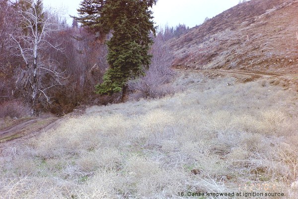
 16.
Detail of ignition source showing dense stands of knapweed and cheatgrass
covering hillsides where fire spread from.
16.
Detail of ignition source showing dense stands of knapweed and cheatgrass
covering hillsides where fire spread from.
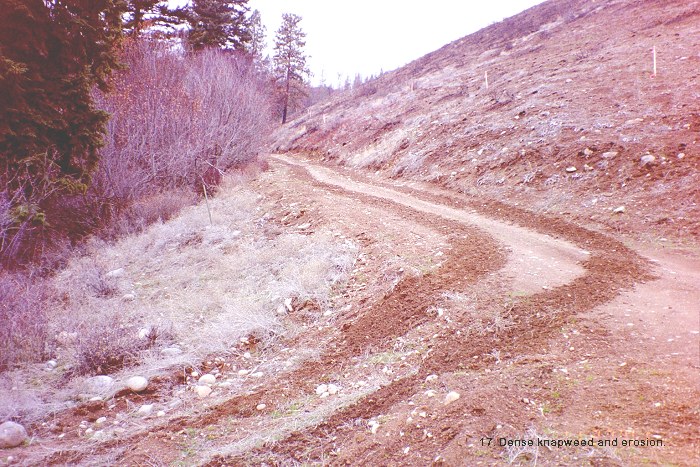
 17.
Detail of ignition source showing knapweed and subsequent erosion which
will continue to enable spread of noxious weeds.
17.
Detail of ignition source showing knapweed and subsequent erosion which
will continue to enable spread of noxious weeds.
 18.
Detail of ignition area showing erosion control grass seedings that helped
spread the fire, but had no effect on knapweed and cheatgrass spreading
from the site. This is a road pullout.
18.
Detail of ignition area showing erosion control grass seedings that helped
spread the fire, but had no effect on knapweed and cheatgrass spreading
from the site. This is a road pullout.
 19.
Detail of ignition source showing erosion-control grass seedings that
helped spread the fire, but had no effect on knapweed spreading (other
side of road).
19.
Detail of ignition source showing erosion-control grass seedings that
helped spread the fire, but had no effect on knapweed spreading (other
side of road).
 20.
Detail of ignition area showing erosion-control grass seedings that ignited
when driven over, yet were ineffective at controlling erosion or spread
of weeds.
20.
Detail of ignition area showing erosion-control grass seedings that ignited
when driven over, yet were ineffective at controlling erosion or spread
of weeds.
 1.
Overview of main part of sale aspen stands are in draw, center of photo.
1.
Overview of main part of sale aspen stands are in draw, center of photo. 3.
Typical ponderosa pine stands comprising approximately 50% of the trust
parcel of 800 acres.
3.
Typical ponderosa pine stands comprising approximately 50% of the trust
parcel of 800 acres.
 5.
Dysfunctional range improvements.
5.
Dysfunctional range improvements.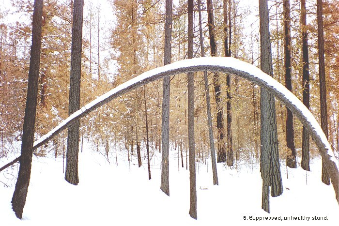 6.
Suppressed, unhealthy stand of trees.
6.
Suppressed, unhealthy stand of trees.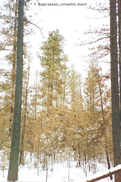 7.
Suppressed unhealthy stands of trees.
7.
Suppressed unhealthy stands of trees. 8.
Proposed landing in wildlife corridor.
8.
Proposed landing in wildlife corridor. 9.
Leave tree stand (the aspens with white bark and red tags).
9.
Leave tree stand (the aspens with white bark and red tags).
 11.
Location of proposed landing adjacent to aspen stand.
11.
Location of proposed landing adjacent to aspen stand. 12.
Woodpecker activity seeking bugs.
12.
Woodpecker activity seeking bugs. 13.
Woodpecker and bug activity.
13.
Woodpecker and bug activity. 14.
Steep, north-facing Douglas fir stand.
14.
Steep, north-facing Douglas fir stand. 15.
Stand of pine and fir without encroaching understory trees.
15.
Stand of pine and fir without encroaching understory trees.